


LAKE PLEASANT Voting District, Maricopa County, Arizona
About
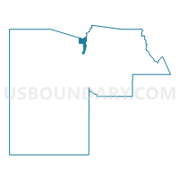
Outline

Summary
| Unique Area Identifier | 524243 |
| Name | LAKE PLEASANT Voting District |
| County | Maricopa County |
| State | Arizona |
| Area (square miles) | 37.35 |
| Land Area (square miles) | 34.87 |
| Water Area (square miles) | 2.49 |
| % of Land Area | 93.34 |
| % of Water Area | 6.66 |
| Latitude of the Internal Point | 33.83673600 |
| Longtitude of the Internal Point | -112.29620490 |
Maps


Graphs
Select a template below for downloading or customizing gragh for LAKE PLEASANT Voting District, Maricopa County, Arizona


Neighbors
Neighoring Voting District (by Name) Neighboring Voting District on the Map
- BISCUIT FLAT Voting District, Maricopa County, AZ
- Castle Hot Springs 1 Voting District, Yavapai County, AZ
- Castle Hot Springs 2 Voting District, Yavapai County, AZ
- CROSSRIVER Voting District, Maricopa County, AZ
- MORRISTOWN Voting District, Maricopa County, AZ
- SONORAN HILLS Voting District, Maricopa County, AZ
- VISTANCIA Voting District, Maricopa County, AZ
- WEST WING Voting District, Maricopa County, AZ
- YEARLING Voting District, Maricopa County, AZ
- ZUNI HILLS Voting District, Maricopa County, AZ
Top 10 Neighboring County Subdivision (by Population) Neighboring County Subdivision on the Map
- Deer Valley CCD, Maricopa County, AZ (258,464)
- Wickenburg CCD, Maricopa County, AZ (93,175)
- Congress CCD, Yavapai County, AZ (9,623)
Top 10 Neighboring Place (by Population) Neighboring Place on the Map
Top 10 Neighboring Unified School District (by Population) Neighboring Unified School District on the Map
- Deer Valley Unified District, AZ (239,044)
- Peoria Unified School District, AZ (203,652)
- Wickenburg Unified District, AZ (11,199)
Top 10 Neighboring State Legislative District Lower Chamber (by Population) Neighboring State Legislative District Lower Chamber on the Map
Top 10 Neighboring State Legislative District Upper Chamber (by Population) Neighboring State Legislative District Upper Chamber on the Map
Top 10 Neighboring 111th Congressional District (by Population) Neighboring 111th Congressional District on the Map
- Congressional District 2, AZ (972,839)
- Congressional District 1, AZ (774,310)
- Congressional District 3, AZ (707,919)
Top 10 Neighboring Census Tract (by Population) Neighboring Census Tract on the Map
- Census Tract 6100, Maricopa County, AZ (7,044)
- Census Tract 6109, Maricopa County, AZ (6,027)
- Census Tract 405.21, Maricopa County, AZ (4,560)
- Census Tract 405.20, Maricopa County, AZ (4,142)
- Census Tract 405.19, Maricopa County, AZ (3,595)
- Census Tract 6108, Maricopa County, AZ (3,505)
- Census Tract 14.02, Yavapai County, AZ (3,496)
- Census Tract 6111, Maricopa County, AZ (3,270)
- Census Tract 6110, Maricopa County, AZ (2,461)